Shandong Fengtu IOT Technology Co., Ltd
Sales Manager:Ms. Emily Wang
Cel,Whatsapp,Wechat:+86 15898932201
Email:info@fengtutec.com
Add:No. 155 Optoelectronic Industry Accelerator, Gaoxin District, Weifang, Shandong, China

Sales Manager:Ms. Emily Wang
Cel,Whatsapp,Wechat:+86 15898932201
Email:info@fengtutec.com
Add:No. 155 Optoelectronic Industry Accelerator, Gaoxin District, Weifang, Shandong, China

Model:FT-BPLD1
Brand:fengtu
1.Introduction to Slope Monitoring System system
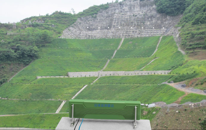
Slope Monitoring System is suitable for field disaster emergency rescue monitoring and slope construction fixed monitoring scenarios.Slope Monitoring System is a high-precision, portable microwave interferometry micro-deformation monitoring product based on a broadband MIMO array.It uses a non-contact method to conduct high-precision uninterrupted cyclic measurements of the target body, and accurately measures the displacement changes and displacement of the monitored target.Speed, it can accurately track slow and tiny displacements, thereby achieving all-day, all-weather, non-contact, high-precision, space-time continuous remote monitoring of the monitored target.It is a new high-precision measuring instrument in the industry.
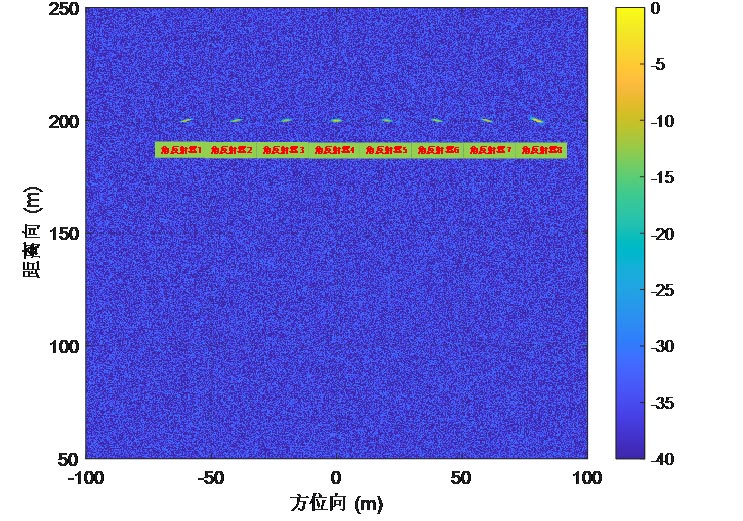
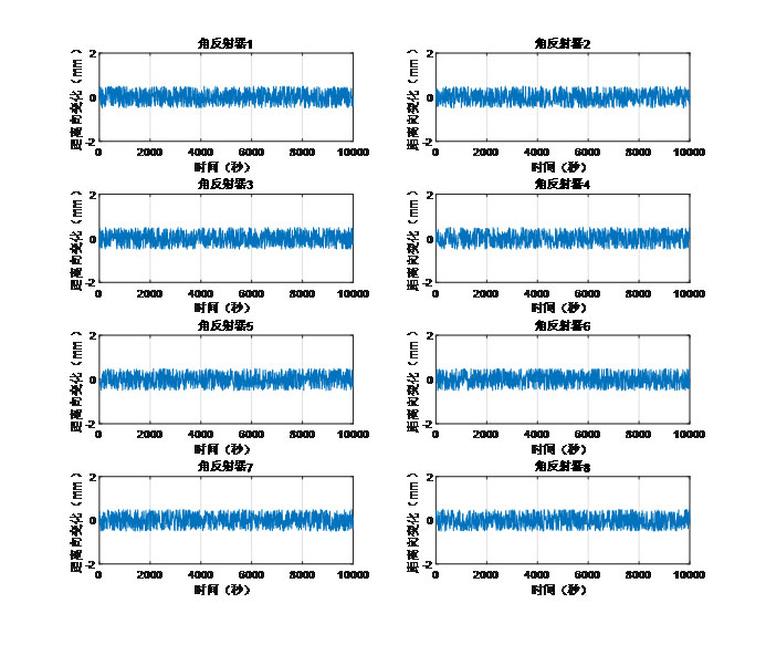
By remotely scanning the surface of the monitoring area, high-precision displacements within the entire area are obtained to achieve continuous monitoring of the entire area.And through comparative analysis of the scan results and the early warning threshold, automatic early warning is achieved to achieve the purpose of early discovery, early warning, ensuring safety, and reducing losses.This product has the characteristics of all-weather, all-weather, large-scale, and high-precision functions, and is suitable for slope deformation monitoring in open-pit mines, water conservancy and hydropower dams, geological landslide disasters, and other scenarios.
2.Slope Monitoring System product usage
Building deformation monitoring
Slope deformation monitoring
Mine deformation monitoring
Foundation pit deformation monitoring
Dam deformation monitoring
3.Product features of Slope Monitoring System
Rapid deployment: instrument deployment takes less than 1 minute
Convenient and fast: single-person installation operation
Measurement accuracy: 0.1mm
Adaptable; 24/7
Cost of use: recycling
Safety risk: No need to approach the measured area
4.Slope Monitoring System complies with specifications
"CH/T 3020-2018 Technical Regulations for Lidar Measurement of Real-life Three-Dimensional Geographic Information Data"
"GJB 6692-2009 General Specifications for Airborne Synthetic Aperture Radar"
5.Slope Monitoring System performance parameters
| Structural form | MIMO, slide rail type, rotating type |
| Erection method | Supports fixed, vehicle-mounted and other installation methods |
| Working frequency band | 5.2-6GHz or 24-26GHz |
| Monitoring information | Displacement/velocity/acceleration |
| Measure distance | ≥5km |
| Measurement accuracy | Deformation accuracy ≤0.1mm |
| resolution | Resolution ≥1㎡ at 1km |
| Monitoring range | Horizontal 100° Vertical 40° |
| Monitoring area | Depends on monitoring distance |
| size | Length x width x height 140cm x 15cm x35cm |
| weight | Less than 10kG |
| Power supply requirements | Supports mains, generator, solar and other power supply modes |
| Monitoring cycle | ≤1s |
| Power consumption | 30W |
| working temperature | -40℃~60℃ |
| Protection level | IP67 |
6.Slope Monitoring System application display


Small automatic weather observation station, referred to as "small weather station", its main work is to collect, organize and process weather data on an automatic basis. With the rapid socio-economic development of China and the improvement of people's quality of life requirements, mo...
Fengtu's Soil Moisture Meter is a capacitive sensor that measures the dielectric constant of the soil medium by detecting changes in the capacitance value on the sensor, thereby calculating the soil's capacitance rate.The Soil Moisture Meter is made of durable materials and can be installed...
Radar water level meter is a non-contact precision water level measuring instrument. The application of this instrument makes the hydrological test transition from the traditional full-time manual observation mode to the modern hydrological digital mode, which improves the efficiency.The radar water...
With the rapid development of science and technology, modern meteorological and environmental monitoring systems, as the core of the operational meteorological monitoring system, are of great significance in enhancing the level of public meteorological services and improving the accuracy of meteorol...