Shandong Fengtu IOT Technology Co., Ltd
Sales Manager:Ms. Emily Wang
Cel,Whatsapp,Wechat:+86 15898932201
Email:info@fengtutec.com
Add:No. 155 Optoelectronic Industry Accelerator, Gaoxin District, Weifang, Shandong, China


Sales Manager:Ms. Emily Wang
Cel,Whatsapp,Wechat:+86 15898932201
Email:info@fengtutec.com
Add:No. 155 Optoelectronic Industry Accelerator, Gaoxin District, Weifang, Shandong, China
time:2025-06-06 09:14:46 source:Weather Station viewed:735 time
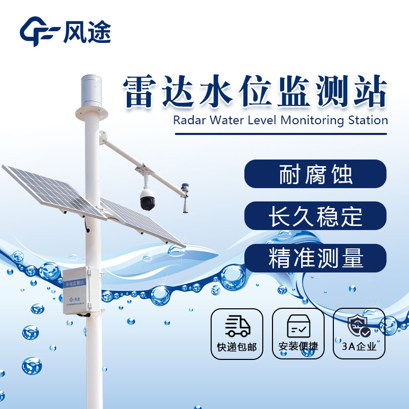
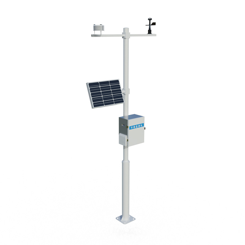
Float-type and pressure-type sensors are prone to being affected by water flow scouring, sediment deposition, water quality corrosion, and floating debris impacts, leading to reduced measurement accuracy, equipment damage, and difficulty in stable operation under severe weather conditions. However, the "non-contact" Water Level Monitoring Station based on radar technology is different.
It adopts K-band (26GHz) planar radar technology. During operation, the radar water level sensor antenna emits radar pulses, which are reflected back from the water surface and received by the antenna, with the time (T) recorded. Since the propagation speed of electromagnetic waves (C) is constant, the distance to the water surface (D) can be calculated using the formula: D = C×T/2. The system performs 55 measurements per second, and through digital filtering processing, it converts nanosecond-level time measurements into millisecond-level data, significantly reducing the impact of water waves on measurement results. The measurement results are nearly equivalent to those of still water level measurements.
With high measurement accuracy reaching the millimeter level and a measurement range of up to 30 meters, its horn antenna design reduces power consumption, and it has a wide input voltage range, making it specially suitable for automatic stations in unmanned field applications. The measurement process is unaffected by factors such as atmospheric temperature, pressure, air density, wind, precipitation, and relative humidity, ensuring extremely strong stability.
In conventional water level monitoring scenarios such as lakes, rivers, reservoirs, open channels, wetlands, and tidal water levels, it stably provides accurate data. In areas with easily changing water quality, its non-contact feature avoids equipment corrosion caused by water quality. In ditches with abundant floating debris and sediments, as well as places with heavy aquatic plant growth, it does not suffer from reduced measurement accuracy due to debris interference. In solar-powered, remote field locations, and mountain flood-prone areas, its low-power consumption and high-stability characteristics make it an ideal choice.
It can also collect water level and rainfall data, featuring real-time clocks, timed storage, parameter setting, and power-off protection for historical parameter data. Equipped with standard RS232/485 communication functions and supporting the MODBUS communication protocol, it can form monitoring systems with computers through various communication methods, including wired connections, mobile wireless GPRS, and wireless data transmission radios. Capable of real-time monitoring and early warning, it automatically triggers an early warning mechanism when water levels are abnormal, sending warning messages to relevant personnel through multiple channels. It can also automatically record and store monitoring data, supporting historical data query and analysis to provide a scientific basis for water resource management decisions.
Wind speed, the speed at which air moves, is a key parameter in meteorology. When the difference in air pressure between two places increases, the speed of air movement increases, resulting in an increase in wind speed and an increase in the force of the wind. For this reason, it is common to use wi...
Hydrological telemetry terminal is a dedicated RTU device for water management, integrating data acquisition, edge computing, and multi-protocol communication. It connects various sensors to automatically collect, process, store, and remotely transmit hydrological data such as water level, flow rate, and rainfall. It is widely used in hydrological monitoring, flood warning, and water resource management....
best temperature sensor measures temperature, humidity, light, carbon dioxide and is ideal for agriculture, weather stations and indoor air quality....
Field water holding capacity is a central indicator for evaluating soil moisture and drought conditions. According to national and water industry standards, soil moisture is the key to determining drought conditions. With the development of automation technology, the number of automatic moisture mon...


 Skype
Skype
 whatsapp
 mail
mail