Shandong Fengtu IOT Technology Co., Ltd
Sales Manager:Ms. Emily Wang
Cel,Whatsapp,Wechat:+86 15898932201
Email:info@fengtutec.com
Add:No. 155 Optoelectronic Industry Accelerator, Gaoxin District, Weifang, Shandong, China


Sales Manager:Ms. Emily Wang
Cel,Whatsapp,Wechat:+86 15898932201
Email:info@fengtutec.com
Add:No. 155 Optoelectronic Industry Accelerator, Gaoxin District, Weifang, Shandong, China
time:2026-05-18 09:55:55 source:Weather Station viewed:94 time
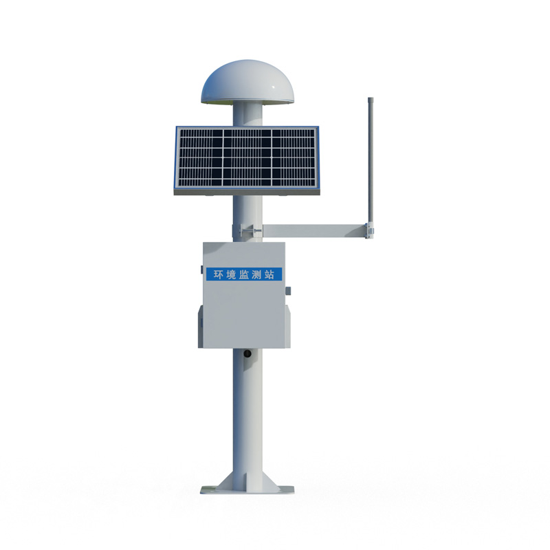
The BeiDou GNSS surface displacement monitoring station employs differential RTK technology, achieving a horizontal accuracy of ±2.5mm + 1ppm and a vertical accuracy of ±5mm + 1ppm. It supports offline calculation and is widely used in safety monitoring of projects such as dams, bridges, and landslides.
The BeiDou/GNSS surface displacement monitoring station is a high-precision deformation monitoring device based on the Global Navigation Satellite System. It achieves millimeter-level displacement monitoring capabilities through differential RTK technology. The device can simultaneously receive satellite signals from multiple systems, including BeiDou, GPS, and GLONASS. Combined with a real-time dynamic differential positioning algorithm, it eliminates various errors generated during signal transmission, improving positioning accuracy to the millimeter level. In actual monitoring scenarios, the device achieves a horizontal accuracy of ±2.5mm + 1/1,000,000 and a vertical accuracy of ±5mm + 1/1,000,000,000, enabling precise sensing of minute deformation processes such as dam settlement, bridge deflection, and slope creep.
The BeiDou GNSS surface displacement monitoring station adopts an integrated design, combining a GNSS receiver, high-precision monitoring antenna, solar power system, and 4G or BeiDou dual-mode communication module into a single unit. This eliminates the need for complex wiring and separate assembly; on-site installation and commissioning can be completed simply by fixing a pole. The equipment comes standard with a 30W solar panel and a 20Ah energy storage battery, enabling 24/7 uninterrupted operation in remote outdoor environments without mains power, completely eliminating dependence on external power sources. The sensor consumes only 0.25 watts, and the overall power consumption is kept below 1 watt. The solar power system can maintain normal operation even during continuous cloudy or rainy days.
Regarding antenna configuration, the BeiDou GNSS surface displacement monitoring station uses a choke coil antenna with composite magnetic absorbing materials to effectively suppress signal interference caused by multipath effects, ensuring stable signal reception quality even in complex terrain and electromagnetic environments. The communication protocol supports Modbus-RTU, allowing devices to directly perform offline calculations and output vertical and horizontal displacements without relying on a backend cloud platform for secondary calculations. It is also compatible with the RTCM3 differential data format, facilitating access to base station networks from different vendors.
In engineering applications, BeiDou GNSS surface displacement monitoring stations have been deployed on a large scale in various fields, including dam safety monitoring, bridge health monitoring, and landslide early warning. The Three Gorges Dam's BeiDou high-precision monitoring system covers key components such as the dam body, slopes, and locks. Its independently developed single-BeiDou calculation system maintains a difference of less than 1.1 millimeters compared to monitoring results obtained using the high-precision line-of-sight method. After introducing the BeiDou high-precision displacement monitoring system, the Yangxi Reservoir in Yongkang City continuously tracks the surface displacement and deformation of the dam, achieving dynamic management of dam operation with millimeter-level monitoring accuracy. The Gansu Electric Power Investment Jiudianxia Hydropower Station has deployed 22 GNSS measuring points using BeiDou positioning technology to capture minute deformations in key areas of landslides and slopes in real time. The system automatically triggers tiered warnings when data exceeds warning thresholds.
The installation of BeiDou GNSS surface displacement monitoring stations must adhere to certain technical requirements. The base station and measuring station should not be obstructed by tall buildings. The baseline distance is recommended to be within 500 meters, with a maximum of 2 kilometers, and installation at the same altitude is preferable. The antenna should be at its highest point within a 20-meter radius, and the mounting base must be secure and reliable. The equipment can operate normally in environments ranging from -40°C to 85°C and with a relative humidity of 0% to 95% without condensation. For baseline distances exceeding 2 kilometers or even 10 kilometers, displacement accuracy may decrease to the 10-centimeter level due to the influence of the electromagnetic environment and terrain.
With the increasing demands for accuracy and real-time performance in engineering safety monitoring, BeiDou/GNSS surface displacement monitoring stations, with their high precision, low power consumption, and integrated deployment advantages, are becoming core equipment for geological disaster prevention and control and the health monitoring of major engineering structures.
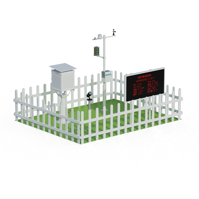
Explosion-proof automatic weather station, mainly used for environmental monitoring and management in electric power, petroleum, chemical and other industries, is a meteorological observation instrument. It can monitor the changes of various meteorological data in the atmosphere exactly within a cer...
In modern society, water quality monitoring plays a vital role in ensuring the safety of domestic water supply and maintaining the stability of the ecological environment. So, how exactly is water quality monitored?Water quality monitoring requires the determination of multiple key indicators....
Industrial Weather Station is specifically designed for flammable and explosive environments such as chemical plants and oil depots. It integrates wind speed, wind direction, temperature, humidity, and atmospheric pressure monitoring, employing high-level explosion-proof and corrosion-resistan...
Outdoor adventure activities such as camping, mountaineering, hiking and fishing have become popular choices for modern urbanites to pursue nature and relax. It is crucial to know the weather conditions of your destination before you set off, but traditional weather forecasts often have wide coverag...


 Skype
Skype
 whatsapp
 mail
mail