Shandong Fengtu IOT Technology Co., Ltd
Sales Manager:Ms. Emily Wang
Cel,Whatsapp,Wechat:+86 15898932201
Email:info@fengtutec.com
Add:No. 155 Optoelectronic Industry Accelerator, Gaoxin District, Weifang, Shandong, China


Sales Manager:Ms. Emily Wang
Cel,Whatsapp,Wechat:+86 15898932201
Email:info@fengtutec.com
Add:No. 155 Optoelectronic Industry Accelerator, Gaoxin District, Weifang, Shandong, China
time:2026-05-07 09:42:23 source:Weather Station viewed:116 time
Utilizing Differential RTK technology, this geological hazard monitoring equipment achieves millimeter-level displacement monitoring for dams, bridges, and landslide bodies. Its built-in sensors are capable of operating around the clock in complex environments, while its data acquisition and early warning system provide real-time, reliable technical support for hazards such as landslides and debris flows.
The geological hazard monitoring equipment is an automated monitoring system specifically designed to address hazards such as landslides, debris flows, and rockfalls. The core technology of this device employs the Differential RTK positioning method, enabling continuous tracking—with millimeter-level precision—of minute displacement changes in target objects within complex geological environments. Unlike traditional manual inspection methods, this system facilitates automated, uninterrupted observation 24 hours a day, requiring no human intervention during the data acquisition and transmission processes.
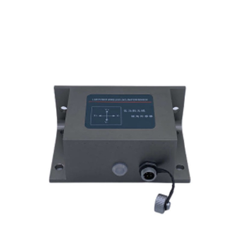
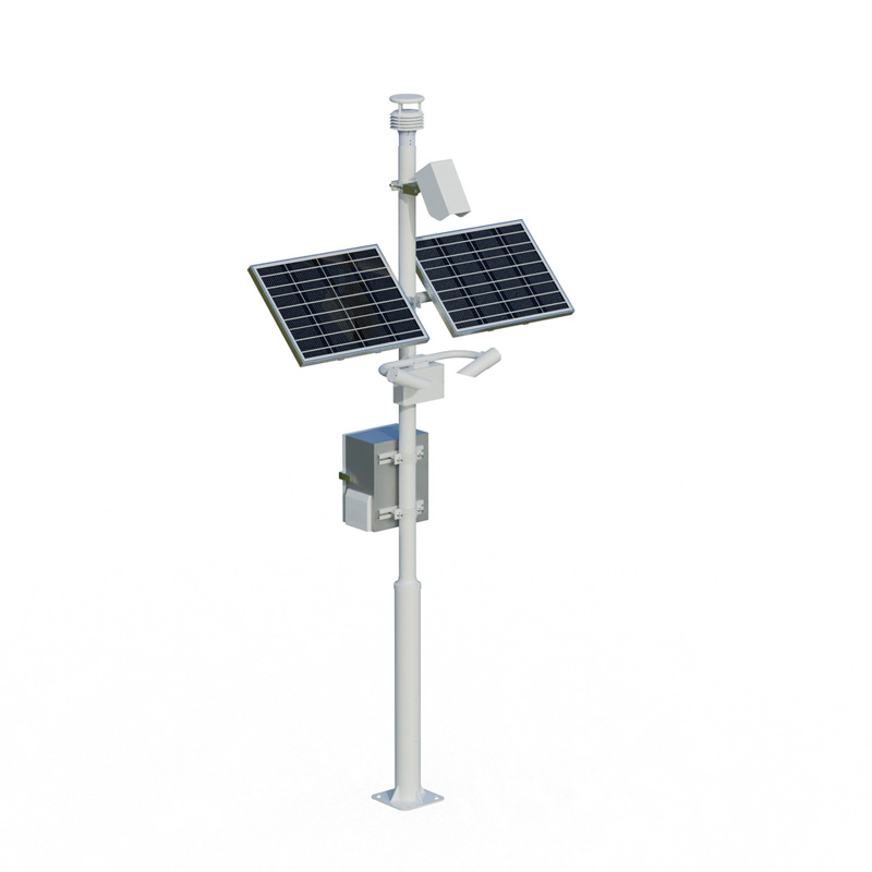
The main components of the geological hazard monitoring equipment include high-precision GNSS receivers, tilt sensors, crack meters, rain gauges, and data transmission units. The GNSS receivers process satellite signals from multiple systems—such as BeiDou and GPS—and utilize Differential RTK algorithms to calculate precise positioning data; this allows for horizontal displacement monitoring accuracy reaching the millimeter level, while vertical displacement accuracy is maintained at an equally high standard. Tilt sensors are installed on the surfaces of landslide bodies or slopes to monitor changes in tilt angles in real time; the system automatically issues an early warning when angle variations exceed a preset threshold. Crack meters are primarily used to measure the dynamics of surface crack opening and closing, accurately reflecting stress change trends at the leading edge of a landslide body. Rain gauges record rainfall intensity and temporal distribution, providing crucial hydrometeorological data for debris flow early warning systems.
This geological hazard monitoring equipment holds broad application prospects across various engineering fields, including dam safety monitoring, bridge structural health assessment, and landslide early warning systems. In dam monitoring scenarios, the equipment is deployed at critical cross-sections of the dam structure to track long-term displacement and settlement trends, thereby assisting engineering managers in assessing the dam's operational status. In the context of bridge structural health assessment, the equipment is installed on piers, pylons, and main girders to monitor the structural deformation responses of the bridge under the influence of vehicular loads and environmental factors. In the field of landslide early warning, a network of multiple monitoring points is established to cover various sections of the landslide body—including its rear edge, central zone, and front edge. The system comprehensively analyzes multi-source data—such as displacement rates, rainfall intensity, and soil moisture content—to issue early warning signals in advance during the critical pre-failure stage of a landslide.
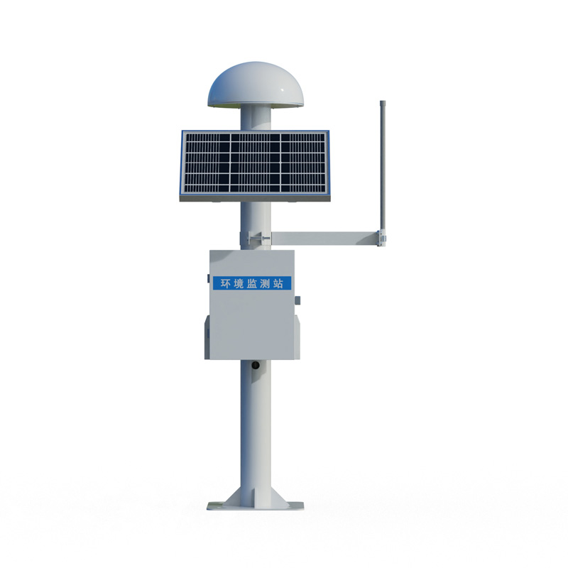
The design of this geological hazard monitoring equipment takes full account of the operational demands of harsh outdoor environments. Its housing features robust waterproofing and dust-proofing capabilities, enabling stable operation under conditions involving rain, snow, high temperatures, and extreme cold. A low-power design allows the equipment to operate maintenance-free for extended periods when powered by solar energy, thereby eliminating the need for frequent battery replacements. Monitoring data is transmitted to a cloud-based platform via 4G networks or the BeiDou Short Message Service; this allows administrators to access real-time monitoring data, displacement curves, and warning statuses at any time via computer or mobile device. The deployment of this monitoring system provides a reliable technical foundation for the prevention and mitigation of geological hazards.
Building an Atmospheric Environment Monitoring System requires consideration from multiple aspects. First, regarding site layout, scientific planning should be carried out based on factors such as urban functional zoning, population distribution, and the location of pollution sources. Urban points f...
In industrial sites, the presence of harmful gases such as combustible gases (EX), hydrogen sulfide (H₂S), and carbon monoxide (CO) poses a serious threat to the safety and physical health of workers.There are various types of combustible gases (EX), such as hydrogen, methane, ethylene, etc....
A radar rain sensor is a sensor that utilizes the radar principle to measure rainfall. It utilizes radar technology to measure the microwave signals reflected back from rainfall, so as to obtain information such as the size, number and speed of raindrops, and then calculate the intensity and amount...
A wind speed meteorometer is a meteorological instrument used to measure wind speed. It is one of the very important devices in meteorological observation and prediction for monitoring and recording the speed and direction of wind in the atmosphere. Anemometers can use different operating principles...


 Skype
Skype
 whatsapp
 mail
mail