Shandong Fengtu IOT Technology Co., Ltd
Sales Manager:Ms. Emily Wang
Cel,Whatsapp,Wechat:+86 15898932201
Email:info@fengtutec.com
Add:No. 155 Optoelectronic Industry Accelerator, Gaoxin District, Weifang, Shandong, China


Sales Manager:Ms. Emily Wang
Cel,Whatsapp,Wechat:+86 15898932201
Email:info@fengtutec.com
Add:No. 155 Optoelectronic Industry Accelerator, Gaoxin District, Weifang, Shandong, China
Model:FT-NJD50
Brand:fengtu
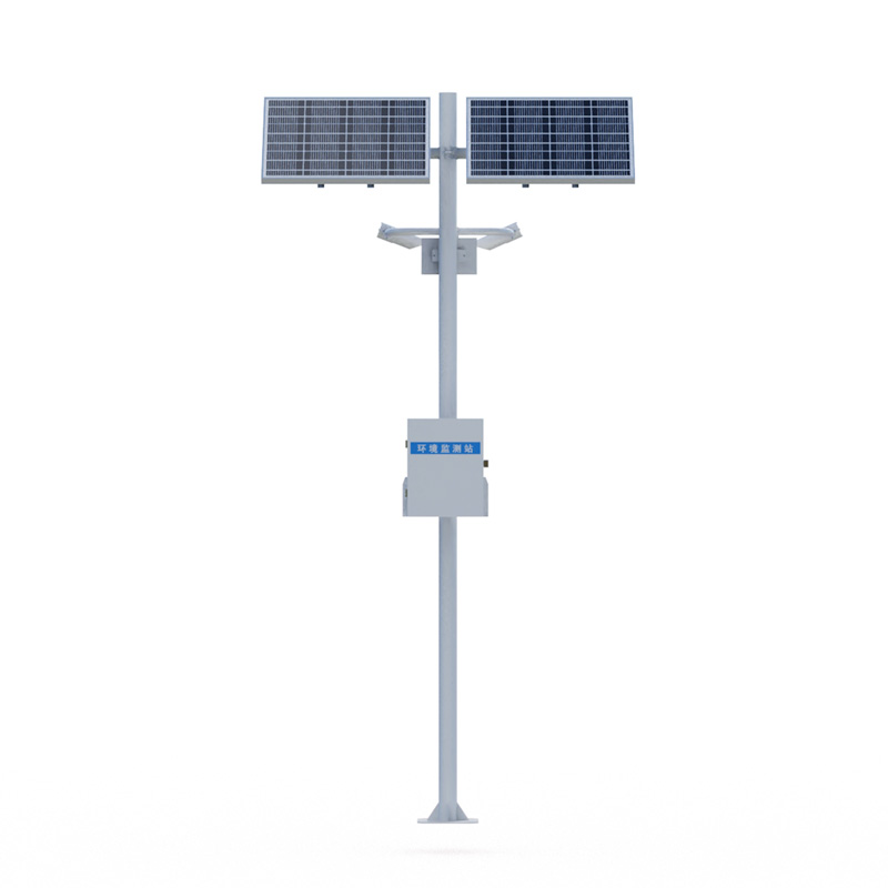
1.Visibility monitoring station product introduction
Visibility monitoring station is a system of equipment used to monitor and record road visibility conditions in real time. It can also monitor multiple meteorological elements.The NJD50 Visibility monitoring station consists of several Visibility monitoring stations distributed along the expressway.It automatically monitors the visibility, current weather phenomena, etc.along the expressway, and promptly transmits the monitoring information to the monitoring for reference for the traffic control system.It can issue warning information in a timely manner under harsh weather conditions, and informs managers and drivers in various ways to improve the driving level of the expressway.In addition, it can also be added at any time according to the actual needs of users: temperature, humidity, wind, pressure and rain integrated meteorological stations, laser remote sensing road condition detectors, etc.to achieve multi-factor meteorological observation.
Visibility monitoring station system composition: visibility sensor, collector, pole bracket, power supply system, cloud platform
2.Visibility monitoring station product features
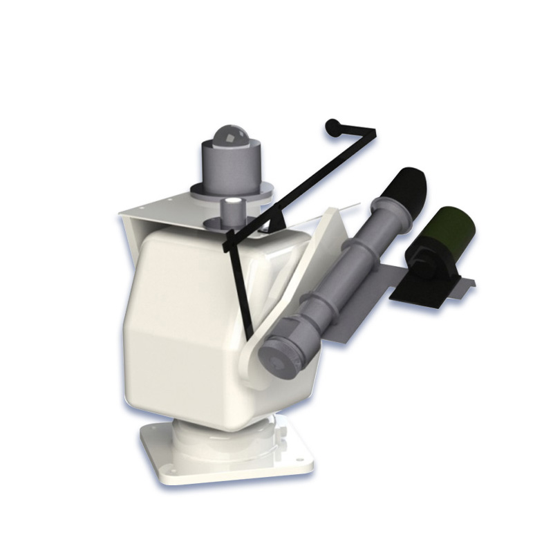
1.Visibility meter: consists of main components such as light emitter, light receiver and microprocessor controller.The transmitter emits infrared pulsed light, and the receiver simultaneously detects the pulse light intensity of forward scattered aerosol particles in the atmosphere.All measurement information is collected by the microprocessor controller and converted into meteorological optical range through a special mathematical model algorithm.
2.Standard GPRS wireless transmission
3.Free choice of two power supply methods: solar power supply and mains power supply
3.Visibility monitoring station technical parameters
Visibility: Principle of measurement aerosol pre-scattering, 0-50km (≤2km ±2%2km~10km ±5%>10km ±10%) resolution 1m
| Main parameters | Parameter range | Resolution | error |
| Range | 50km | 1m | ≤2km ±2%2km~10km ±5%>10km ±10% |
| Repeatability | ≤4% | ||
| Weather phenomena | Fog, rain, snow, mixed precipitation, sunny | ||
| Weather phenomenon recognition rate | ≥95% | ||
| Operating temperature | -40~60℃ | ||
| Working humidity | 0~100%RH | ||
| Working power supply | 12~24V | ||
| Power consumption | 1W | ||
| size | 610x230x360mm (Length x Width x Height) | ||
| weight | ≤10kg | ||
4.Introduction to the Visibility monitoring station cloud platform
1.CS architecture software platform, supports direct observation of mobile phones and PC browsers without additional software installation.
2.Support multiple accounts and multiple devices to log in
3.Support real-time data display and historical data display dashboard
4.Cloud server and cloud data storage are stable and reliable, easy to expand, and load balancing.
5.Support SMS alarm and threshold settings
6.Support map display and viewing device information.
7.Support data curve analysis
8.Support data export table form
9.Supports data forwarding, HJ-212 protocol, TCP forwarding, http protocol, etc.
10.Support data post-processing function
11.Support external running of javascript scripts
Every year, before the spring ploughing and during the autumn harvest, the agriculture department monitors the soil moisture level and advises farmers on suitable farming practices. This is because moisture is important for crop growth. Monitoring moisture can help farmers to time their irrigation,...
The Fixed Ultrasonic Flow Meter is an instrument that measures flow based on the characteristics of ultrasonic propagation in fluids. Its working principle is rooted in the fact that when ultrasonic waves travel through a fluid, the propagation time in the downstream and upstream directions varies w...
The Compact Multi-Parameter Automatic Weather Monitoring Station is a small-sized device that integrates numerous weather monitoring technologies. Favoured for its lightweight form factor and easy installation process, it allows for rapid deployment in diverse environments for continuous weather con...
Ultrasonic wind speed and direction meter is an advanced equipment to measure wind speed and direction through ultrasonic waves. Its working principle is to utilize the characteristics of ultrasonic wave propagation in the air to deduce the wind speed and direction by measuring the difference betwee...


 Get a Free Quote
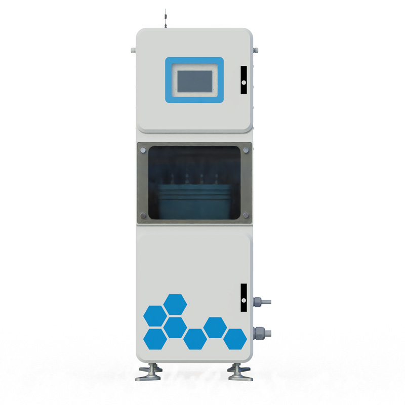
 Skype
Skype
 whatsapp
 mail
mail