Shandong Fengtu IOT Technology Co., Ltd
Sales Manager:Ms. Emily Wang
Cel,Whatsapp,Wechat:+86 15898932201
Email:info@fengtutec.com
Add:No. 155 Optoelectronic Industry Accelerator, Gaoxin District, Weifang, Shandong, China


Sales Manager:Ms. Emily Wang
Cel,Whatsapp,Wechat:+86 15898932201
Email:info@fengtutec.com
Add:No. 155 Optoelectronic Industry Accelerator, Gaoxin District, Weifang, Shandong, China
time:2024-11-22 09:40:21 source:Weather Station viewed:741 time
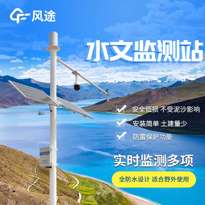
Measuring water surface velocity is of crucial importance in the fields of water conservancy and hydrology. In flood control work, accurate water surface velocity data helps to precisely predict the flood path, flood peak intensity and arrival time, ensuring the safety of the lives and property of residents along the river and buying precious time for flood fighting and rescue. In the construction of water conservancy projects, the design and construction of dams, waterways and other projects rely on this key parameter of water surface velocity, which is related to the stability and rationality of the projects. When it comes to water resource management and allocation, mastering the water surface velocity of different river sections and different periods can make water resource distribution more scientific and efficient.
The Radar Flow Meter FT - ML3 provides a solution for velocity measurement. It can monitor the open channel water flow throughout the process without being affected by various factors such as temperature and humidity, and is suitable for open channel channels such as irrigation areas and river channels.
This system consists of a three - in - one radar water level, surface velocity and flow, a telemetry terminal unit RTU, a solar power supply system, a pole and bracket and lightning protection grounding. Its core component is based on pulsed radar technology. At a regular cross - section, the flow is calculated according to mathematical and geometric principles by combining the measured velocity and water level.
Non - contact flow measurement is its outstanding advantage. It can be installed with water, without being blocked by water flow or ponding, and is not affected by debris, floating objects, water quality and sediment. It has a particularly good effect on channels with fast velocity and large flow. However, it also has limitations. Wind speed, slow velocity, sandstorms and heavy rainfall weather will cause measurement errors.
The range of water level measurement of this system is 0.4 - 40 meters, with an accuracy of ± 1cm and a resolution of 1mm; the velocity measurement range is 0.15 - 15m/s, with an accuracy of ± 2% and a resolution of 0.01m/s. Despite the interference factors, it can still provide key data support for water conservancy projects and water resource allocation and is a powerful assistant for open channel flow monitoring.
Soil moisture monitoring devices can help farmers quickly know how wet the soil is, and a device like a tube moisture sensor can tell farmers how wet the soil is in real time, allowing them to make better decisions about when to water and help their crops grow better.Its use of FDR technology allows...
In this day and age, the importance of water resources cannot be overstated, as it is a basic condition essential to the survival of human beings and living things. Water pollution and continuous consumption of water resources become more and more scarce, which puts forward serious problems and chal...
The rainfall real-time monitoring system is widely used in hydrology, meteorology and flood control. It consists of rain gauge, data collector and computer. By analyzing and processing the rainfall information collected from the automatic monitoring stations, the rainfall value of each rainfall moni...
Highway environmental meteorological monitoring system has been widely used in road construction with its advantages of convenience, speed and accuracy. However, due to the special nature of highway construction conditions, the environmental meteorological observation equipment puts forward high req...


 Skype
Skype
 whatsapp
 mail
mail