Shandong Fengtu IOT Technology Co., Ltd
Sales Manager:Ms. Emily Wang
Cel,Whatsapp,Wechat:+86 15898932201
Email:info@fengtutec.com
Add:No. 155 Optoelectronic Industry Accelerator, Gaoxin District, Weifang, Shandong, China


Sales Manager:Ms. Emily Wang
Cel,Whatsapp,Wechat:+86 15898932201
Email:info@fengtutec.com
Add:No. 155 Optoelectronic Industry Accelerator, Gaoxin District, Weifang, Shandong, China

Model:FT-TK2
Brand:fengtu
1.Cloud Monitoring Overview
Cloud Monitoring is a ground-based cloud observation instrument used to measure the amount of clouds in the whole sky and image the whole sky at regular intervals.With the development of natural science, cloud observation continues to be valued. In the early days, cloud observation required professionals to observe with the naked eye and record the observation results manually. The accuracy of the observation results varied greatly depending on the experience and technical level of the observer. In order to reduce labor costs, improve observation accuracy, and achieve unattended all-weather automatic observation of the sky, Cloud Monitoring has gradually replaced manual observation. Cloud Monitoring, combined with the use of machine deep learning algorithms, has greatly improved the degree of automated cloud observation and enhanced people's ability to study and utilize solar energy resources.
2. Cloud Monitoring Function Description
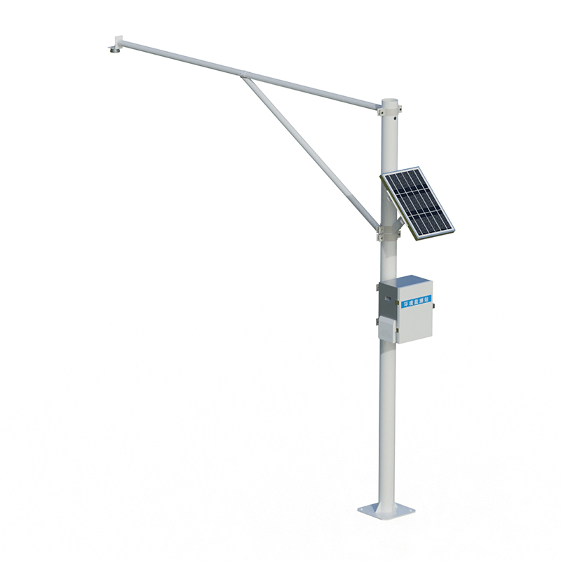
FT-TK2Cloud Monitoring is a new generation of fully automatic, full-color sky imaging equipment independently developed by our company. The device has an ultra-large viewing angle of 220°. Through IOT intelligent network technology, it can transmit real-time image information and meteorological data to the back-end computing center. After the data is processed by quality control and AI image recognition model, the real-time image data, cloud coverage, transmittance and additional weather data are provided to the user terminal in various forms.
3. Cloud Monitoring Hardware Specifications
Image sensor: 1/2.7" Progressive Scan CMOS 5 megapixels (default 2 megapixel output, 2 megapixel, 3 megapixel, 5 megapixel three levels can be adjusted remotely through the cloud)
Minimum illumination: Color: 0.01Lux F1.2
Image signal-to-noise ratio: ≥50dB (AGC OFF)
Wide dynamic range: ≥80dB
Maximum image resolution: 2592×1944
Supported image resolution: 2592×1944/2560×1920/2048×1536/1080P (1920×1080)
Lens angle of view: about 220° full fisheye
Focal length: 2.8mm
Aperture: F1.8
Input voltage range: 11~13.5VDC, standard input voltage: 12VDC (supports adapter and solar power)
The maximum power consumption of the whole machine does not exceed 10W, and the average power consumption is 6.5W
Network communication method: 4G
Temperature and humidity sensor:
Temperature: Sensor accuracy ±0.3℃, applicable range 0℃~65℃, use range -20℃~55℃
Humidity: Sensor accuracy ±3%RH, applicable range 10%RH~90%RH, use range 0%RH~100%RH
Atmospheric pressure sensor: sensor accuracy ±1hpa, range 300hpa~1100hpa
Working temperature -20℃~55℃
button:
Power button: power on/off
Setup button: When the device is running, press it and wait for a while, the device will enter Bluetooth mode, which is used for user binding and resetting the network.
Indicator Lights:
Power on: The yellow light stays on for no more than 5 seconds
Bluetooth mode: red and green lights, flashing intermittently every second
Running status: 4G network mode, green light flashes once every 10 seconds
No network available: Red light flashes for 30 seconds
Weather data and image sampling frequency is adjustable, uploading once every 1 minute
Product material: PC
External dimensions (length, width and height): 305x175x330mm
Waterproof rating: IP55
Product weight: 2kg
Installation method: Pole
Single set configuration list
| Serial number | Product Name | model | Key Features |
| 1 | Sky Imager | FT-TK2 | ①Fisheye sky camera (vertically facing the sky) ② Temperature ③Relative humidity ④Air pressure |
| 2 | Communication System | ①Wired network direct communication | |
| 3 | Supporting Software | APP and web services | ① View live broadcast ②View and download historical data ③View image chart ④Basic data interface service ⑤View real-time sky images, view and download historical sky image data |
| 4 | Sky Image Algorithm System | Image processing algorithm analysis service for 2 years | |
| 5 | Mains electricity | —— | Support mains power |
| 6 | Mounting Bracket | —— | 2m installation pole |
How to measure turbidity online? You can try this Online turbidity sensor.The turbidity of water quality refers to the degree of water turbidity, which is caused by the presence of suspended particles, colloidal substances, etc. in the water. These suspended substances will scatter and absorb light,...
Soil moisture, that is, the degree of wetness of soil, is very important for agricultural irrigation, environmental protection and disaster prevention. By establishing the Automatic Soil Monitoring System, we can more accurately understand the changes in soil moisture, so that we can more effectivel...
A soil moisture monitoring system is an automated system used to monitor soil moisture conditions, which can help farmers or agricultural researchers better understand soil moisture conditions in order to develop more effective irrigation schedules and crop management strategies.Soil moisture monito...
In the current context where water resource protection is becoming increasingly important, the Online Multi - parameter Water Quality Analyzer is widely used in water quality monitoring work due to its two major advantages of "online rapid detection" and "low cost".Traditional wa...


 Get a Free Quote
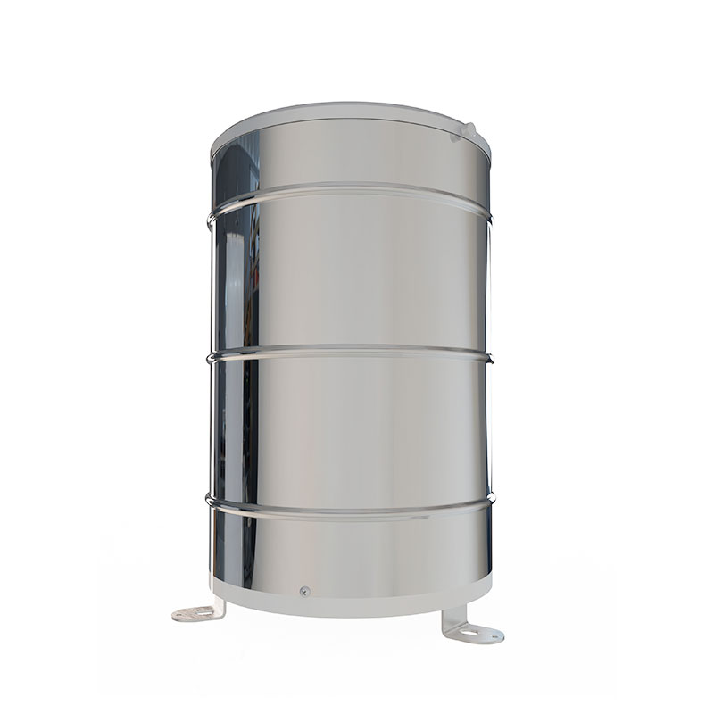

 Skype
Skype
 whatsapp
 mail
mail