Shandong Fengtu IOT Technology Co., Ltd
Sales Manager:Ms. Emily Wang
Cel,Whatsapp,Wechat:+86 15898932201
Email:info@fengtutec.com
Add:No. 155 Optoelectronic Industry Accelerator, Gaoxin District, Weifang, Shandong, China


Sales Manager:Ms. Emily Wang
Cel,Whatsapp,Wechat:+86 15898932201
Email:info@fengtutec.com
Add:No. 155 Optoelectronic Industry Accelerator, Gaoxin District, Weifang, Shandong, China

Model:FT-FS3
Brand:fengtu
Photosynthetically active radiometer Product Introduction
Photosynthetically active radiometer is mainly used to measure the photosynthetically active radiation of natural light in the wavelength range of 400-700nm, and it is simple to use.
Photosynthetically active radiometer technical specifications
Power supply: DC12V
Power consumption: 0.036W
Working environment: -20~65℃
Communication interface: RS485
Working current: 3mA@DC12V
Minimum data interval: 0.5S
Photosynthetically active radiometer sensor parameters
| parameter | scope | Resolution | Accuracy | unit |
| Photosynthetically Active Radiation | 0-2000 | 1 | <±3% | W/m² |
Response time: ≤10S
Annual stability: ≤±3%
Zero drift: ≤10 W/m²
Measurement spectrum: 400~700nm
The Ultrasonic Wind Speed & Direction Sensor is a highly accurate wind measurement device in meteorological measurements. Its working principle is to use the flight time of ultrasonic pulses to detect the wind speed.This device is usually composed of four ultrasonic transducers arranged north, s...
Measuring visibility is crucial for ensuring traffic safety, especially in fields such as highways, railways, aviation, and shipping. Low visibility significantly increases the risk of accidents. Visibility data is very important for improving the accuracy of weather forecasts, conducting climate re...
In industrial production and urban gas transmission, methane leakage is an extremely dangerous hidden hazard. Traditional detection methods often require close contact with the detection points, which is not only inefficient but also poses safety risks. However, the Laser Methane Telemeter can reali...
GNSS surface displacement monitoring instrument is a device that utilizes high-precision satellite navigation systems and differential RTK technology to achieve millimeter-level displacement monitoring. It features all-weather real-time monitoring capabilities and is specifically designed for surface displacement and building deformation monitoring, widely used in engineering safety fields such as dams, bridges, and landslides....


 Get a Free Quote
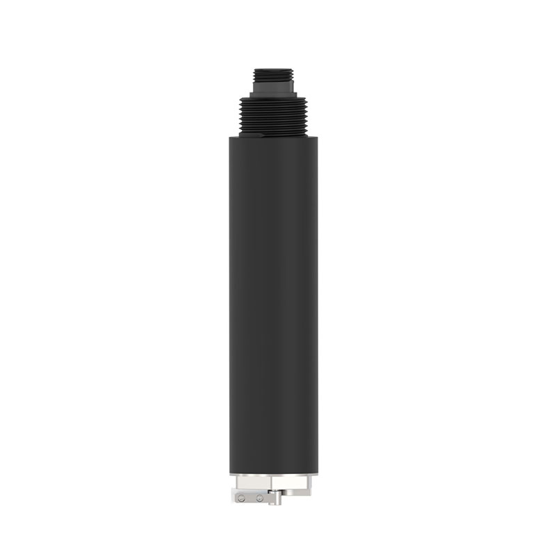
 Skype
Skype
 whatsapp
 mail
mail