Shandong Fengtu IOT Technology Co., Ltd
Sales Manager:Ms. Emily Wang
Cel,Whatsapp,Wechat:+86 15898932201
Email:info@fengtutec.com
Add:No. 155 Optoelectronic Industry Accelerator, Gaoxin District, Weifang, Shandong, China


Sales Manager:Ms. Emily Wang
Cel,Whatsapp,Wechat:+86 15898932201
Email:info@fengtutec.com
Add:No. 155 Optoelectronic Industry Accelerator, Gaoxin District, Weifang, Shandong, China

Model:FT-DZLD1
Brand:fengtu
1.Purpose of Portable Ground Penetrating Radar product
Portable Ground Penetrating Radar emits high-frequency electromagnetic waves to infer the spatial position, structure, shape and burial depth of underground media.It is suitable for projects related to geological disaster assessment and management, engineering survey and design; engineering survey, municipal pipelines, road bridges, tunnel detection and other fields, and is used to detect or identify information on metal or non-metallic targets within a certain depth underground.The specific categories are as follows:
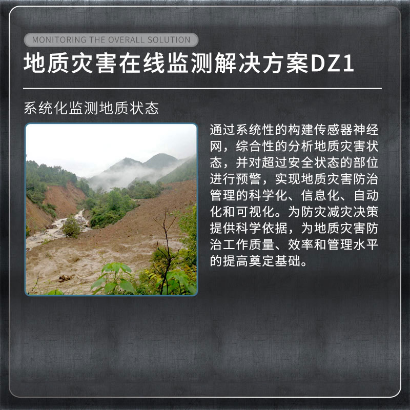
Geological hazard assessment: used to identify underground space anomalies such as cavities, voids, fracture zones and other geological information;
Engineering survey: used to find out information about underground anomalies in the project area, such as karst, collapse, fracture zones, etc.;
Municipal pipelines: used to identify the distribution of underground metal or non-metallic pipelines during urban construction;
Roads and bridges: Used to identify unfavorable geological bodies during the site selection process of roads or bridges;
Tunnel detection: used for advance prediction of tunnels, detection of tunnel construction quality, etc.;
2.Product features of Portable Ground Penetrating Radar
This product adopts the industry-leading integrated design of host and antenna, which is small in size, light in weight and low in power consumption;
The host and computer are connected wirelessly, making operation easy;
Real-time data collection and display;
The software interface is simple, easy to operate and quick to get started;
Multi-band antennas are optional and have a wide range of applications;
The analysis software is simple to operate and the results are interpreted accurately;
High detection accuracy and accurate positioning;
Built-in large-capacity battery with long battery life;
Ergonomic structural design, simple, durable and easy to operate, very suitable for mobile working environments in the field.
3.Portable Ground Penetrating Radar complies with specifications
"Geophysical Exploration Regulations for Hydropower and Water Conservancy Projects DL/T 5010-2005"
"Geophysical Exploration Regulations for Water Conservancy and Hydropower Projects SL326-2005"
"Technical Regulations for Geophysical Exploration of Electric Power Engineering DL/T 5159-2012"
"Underwater Engineering Geophysical Exploration Regulations DB34/T 2209-2014"
"Highway Section Flaw Detection and Structural Layer Thickness Geological Radar JT/T 940-2014"
"Urban Engineering Geophysical Detection Standard CJJ/T 7-2017"
"Technical Regulations for Detection of Urban Underground Pipelines CJJ 61-2017"
"Technical Regulations for Quality Detection of Construction Projects by Radar Method DGJ 32-TJ79-2009"
"Technical Regulations for Advanced Geological Forecasting of Railway Tunnels Q/CR 9217-2015"
"Technical Standard for Comprehensive Detection and Risk Assessment of Urban Underground Diseases JGJT437-2018"
"Geophysical Prospecting Regulations for Highway Engineering JTGT 3222-2020"
4.Portable Ground Penetrating Radar performance parameters
| Host | Antenna type | Single shielded antenna |
| Antenna frequency | 200MHz | |
| Sampling frequency | 0.2-100GHz adjustable | |
| time window range | 1ns~20000ns, continuously adjustable | |
| Number of sampling points | 32~32767 samples/scan, optional | |
| scan rate | 200 lines/second | |
| A/D conversion | 18bit | |
| continuous working time | ≥8 hours | |
| Machine power consumption | <16W | |
| signal-to-noise ratio | Better than 120dB | |
| Collection speed | > 60 km/h @ 5 cm horizontal sampling spacing (track spacing) | |
| Minimum sampling interval | <10ps | |
| Measurement method | Three measurement methods: point-by-point measurement, distance-triggered measurement, and continuous measurement | |
| Display mode | Pseudo-color images, stacked waveforms or grayscale images | |
| working temperature | -30℃~+70℃ | |
| Working voltage | 10-15VDC | |
| Wireless data transmission distance | greater than 50 m | |
| Wired communication | Ethernet, 100Mbps | |
| weight | <8kg |
Measuring snow depth data to better understand snow conditions is important for many industries and fields. Here are a few common application scenarios:1. Transportation: Snow depth data is an important basis for transportation departments to develop road arrangements and traffic control, especially...
The Compact Multi-Parameter Automatic Weather Monitoring Station is a small-sized device that integrates numerous weather monitoring technologies. Favoured for its lightweight form factor and easy installation process, it allows for rapid deployment in diverse environments for continuous weather con...
2D Ultrasonic Anemometer is a precision measuring instrument based on the ultrasonic time-of-flight principle, capable of simultaneously measuring horizontal wind speed and direction. The device features an integrated stainless steel design, a robust structure, fast response speed, and accurate measurement data....
Wind speed and direction measuring devices were probably one of the first types of sensors to be developed in history. Since ancient times, knowing the speed and direction of the wind has been of great importance in many fields such as agriculture, navigation, and construction. This article will loo...


 Get a Free Quote
 Skype
Skype
 whatsapp
 mail
mail