Shandong Fengtu IOT Technology Co., Ltd
Sales Manager:Ms. Emily Wang
Cel,Whatsapp,Wechat:+86 15898932201
Email:info@fengtutec.com
Add:No. 155 Optoelectronic Industry Accelerator, Gaoxin District, Weifang, Shandong, China


Sales Manager:Ms. Emily Wang
Cel,Whatsapp,Wechat:+86 15898932201
Email:info@fengtutec.com
Add:No. 155 Optoelectronic Industry Accelerator, Gaoxin District, Weifang, Shandong, China
time:2023-01-30 21:47:19 source:Weather Station viewed:1147 time
As an important part of the ecosystem, wetlands play a pivotal role in maintaining biodiversity and providing human health. As global climate change and water scarcity become more and more prominent, people are increasingly concerned about the impact of protecting and utilizing natural resources on socio-economic development. Wetlands have the functions of water conservation, flood and drought prevention, air purification, microclimate regulation and flood water storage, as well as rich wildlife resources and unique biological landscapes. However, due to population growth, accelerated urbanization and industrial pollution, environmental damage and other factors, many of China's wetlands have been seriously disturbed and threatened. Wetland degradation has become a major problem facing the world today.
Wetland monitoring is one of the main tools to evaluate and protect wetlands, which directly reflects the basic condition of wetlands and can be scientifically and reasonably managed and developed according to the actual situation. Wetland monitoring includes both meteorological monitoring and remote sensing monitoring. Meteorological monitoring is to obtain parameters such as temperature, salinity and precipitation in the wetland surface soil through detection methods such as meteorological stations.
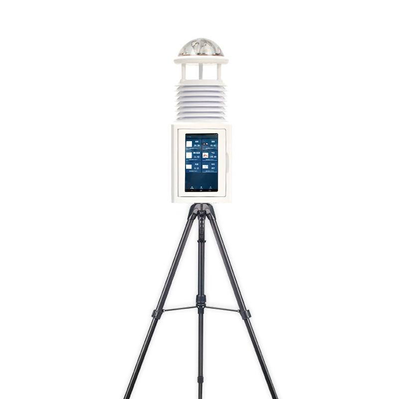
Wetland meteorological stations include a monitoring terminal and a software platform, which collects all meteorological information. It mainly includes air temperature, relative humidity, wind speed, wind direction, rainfall, radiation, PH, dissolved oxygen, turbidity, blue-green algae, ammonia nitrogen, water level, flow rate, soil water content, soil temperature, soil salinity, PM10, PM2.5, etc.
Comprehensive monitoring of meteorology, hydrology and water quality, soil, air quality, etc.

weather instruments and its uses are thermometers, barometers, rain gauges, wind vanes, anemometers, and hygrometers that measure temperature, pressure, rainfall, wind direction, wind speed, and humidity, respectively....
Automatic ambient air quality monitoring station is an important branch in the field of environmental monitoring in China, which realizes environmental quality management by monitoring and analyzing atmospheric environmental quality. With the continuous development of China's economy and the inc...
best weather stations for home can be used to monitor air temperature, humidity, atmospheric pressure, wind speed, wind direction....
Industrial boilers are devices used to heat water into steam, which can be employed to drive turbines for power generation, provide heat sources for production workshops, and so on. If the hardness of boiler water is high, calcium and magnesium ions in the water will form scale on the heating surfac...


 Skype
Skype
 whatsapp
 mail
mail