Shandong Fengtu IOT Technology Co., Ltd
Sales Manager:Ms. Emily Wang
Cel,Whatsapp,Wechat:+86 15898932201
Email:info@fengtutec.com
Add:No. 155 Optoelectronic Industry Accelerator, Gaoxin District, Weifang, Shandong, China

Sales Manager:Ms. Emily Wang
Cel,Whatsapp,Wechat:+86 15898932201
Email:info@fengtutec.com
Add:No. 155 Optoelectronic Industry Accelerator, Gaoxin District, Weifang, Shandong, China
time:2024-12-02 09:30:30 source:Weather Station viewed:180 time
China is frequently stricken by diverse geological disasters. Among them, debris flow, as one of the highly destructive disasters, has always been a key research object in the field of geological disaster prevention and control. Debris flow is the result of catastrophic damage to the geological environment caused by natural and human-induced geological processes. Its occurrence is often accompanied by phenomena such as collapses and landslides, which can cause severe damage to the surrounding areas in a short time, threatening people's lives and property safety as well as social stability and development.
Our company deeply integrates structural health monitoring with cutting-edge technologies such as the Internet of Things and cloud computing to construct a comprehensive debris flow monitoring system. By carefully arranging a sensor network, it is like equipping the geological environment with sensitive sensing organs, which can comprehensively and accurately monitor various types of information related to debris flow.
In terms of monitoring items, it covers several key elements:
Surface displacement monitoring: The integrated GNSS monitoring system is used to precisely measure the position changes of the surface at different times and timely detect surface anomalies that may indicate the occurrence of debris flow.
Crack monitoring: The integrated surface displacement monitoring system is employed to meticulously monitor the generation and expansion of surface cracks, as the change of cracks is often a prelude to the formation of debris flow.
Deep displacement monitoring: The integrated deep displacement monitoring system is adopted to deeply probe the displacement conditions of the underground soil or rock mass, so as to understand the stability changes of the geological structure at a deeper level.
Groundwater level monitoring: The integrated pore water pressure monitoring system can monitor the fluctuations of the groundwater level in real time. The abnormal rise of the groundwater level may lead to soil saturation and increase the risk of debris flow.
Soil moisture content monitoring: The integrated soil temperature and humidity monitoring system can accurately grasp the soil moisture content. Excessively high moisture content will reduce the shear strength of the soil and easily trigger debris flow.
Rainfall monitoring: The integrated rain gauge monitoring system records the rainfall situation in real time. Heavy rainfall is one of the important inducing factors for debris flow.
Video surveillance: The integrated video surveillance system is like the "eyes" on the site, intuitively observing the overall situation of the monitoring area. When a warning is issued, it can quickly provide the actual scene of the site to assist in decision-making.
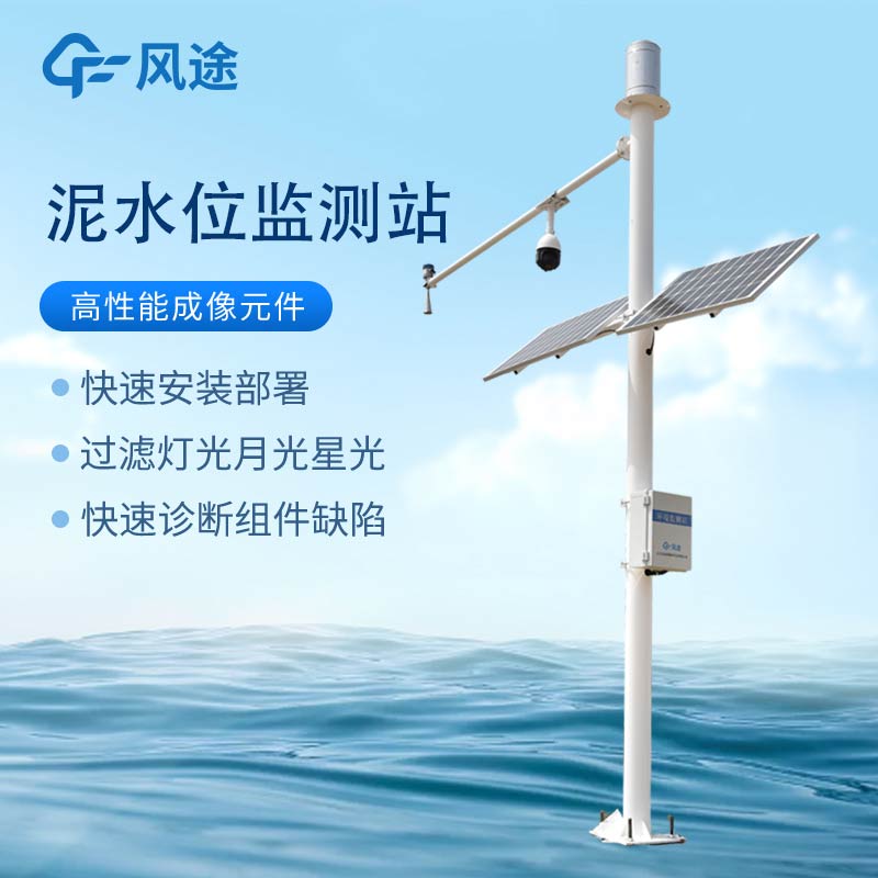
Mud water level monitoring: The dedicated mud water level monitor can accurately monitor the changes of the mud water level, which is of crucial significance for judging the scale and development trend of debris flow.
The monitoring work strictly follows a series of professional norms, such as "Technical Specification for Geological Disaster Monitoring DB11/T 1677 - 2019", "Technical Specification for Safety Monitoring of Geological Disaster Control Engineering T/CAGHP 044 - 2018", "Specification for Monitoring of Collapse, Landslide and Debris Flow DZ/T0221 - 2006", etc., to ensure the accuracy and reliability of the monitoring data.
The debris flow monitoring system has powerful functions:
First, the automated monitoring platform breaks the limitations of weather and realizes all-weather geological information security monitoring and process management. Once an abnormality occurs in the monitoring area and triggers a warning, the video monitoring can immediately present the site situation. At the same time, according to the warning level, the system will notify the relevant responsible units in multiple alarm ways, prompting them to quickly start the emergency plan, evacuate the surrounding people and transfer materials in a timely manner, minimizing the losses caused by accident disasters.
Second, a multi-level early warning and alarm mechanism from province - city - county - township has been established, which can not only issue early warnings in a timely manner but also provide corresponding emergency plans, truly achieving seamless integration of disaster monitoring, warning and response. Through long-term real-time automated monitoring, it effectively prevents the occurrence of major debris flow disasters, reduces economic losses, maintains social harmony and stability, and safeguards the people's well-being and the sustainable development of the region.

The Micro water quality monitor FT-WMSM is a device meticulously designed to meet the complex needs of water environment monitoring.FT-WMSM adopts a highly integrated design, compactly and rationally integrating the water sampling and distribution system, detection unit, quality control unit,...
Automatic rainfall monitoring station itself is a means to monitor rainfall, water level and other parameters. It can provide timely information on rainfall, water level, etc. in the rainy season, which is beneficial to the people to protect their lives and properties from losses. With strong anti-i...
weather detecting technology is a device that measures and monitors meteorological conditions and is used for weather forecasting, weather monitoring, and other meteorological services....
how does a rain gauge work? Placed in an open area, it is measured based on the height of the precipitation that has accumulated in the container at a given time, and the change in rainfall over time is recorded....